
Canadian Maps
139 Maps
| Maps Home >> Military Maps >> World War 2 >> Normandy Bridgehead |
Image has been Resized!
 View Full Image
View Full Image
|
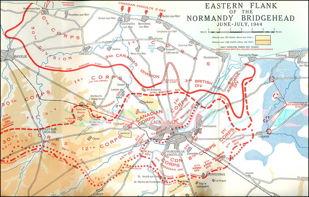
Description Eastern flank-Normandy Bridgehead
June-July 1944 |
Posted Comments
No comments. Why don't you go ahead and post one!?
You want to post comments ? First you must Register!
Canada Kicks Ass!
Commented Pics
 Sex Flow Chart in Gender Humour
November 15th, 2020 by cobrass Divine Light in Gender Humour
November 15th, 2020 by cobrass Ash in Babe Wallpapers
August 15th, 2020 by Vanucx Maple Leaf Collage in Maple Leaf
October 12th, 2018 by homebound Another Chinese Toy Recall in Illusions
November 6th, 2016 by Hyack
Canadian Content
Latest Topics in Canadian Forums
- Stephanie Kelton - �Finding the Money� & �The Deficit Myth�
[Business] Last post by DrCaleb
