
Canadian Maps
139 Maps
| Maps Home >> Historical Maps >> 1800's >> Province of Manitoba, 1871 |
Image has been Resized!
 View Full Image
View Full Image
|
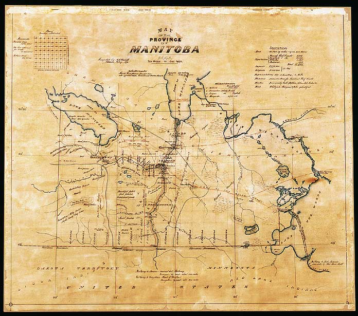
Description This is the oldest map of the province of Manitoba, which had just been created. The M�tis rebellion had just taken place, and the map shows the juxtaposition of their surveying system and the system of new townships created by the govenment. The prime meridian, the backbone for surveying, is shown west of Pembina on the American border.
|
Posted Comments
No comments. Why don't you go ahead and post one!?
You want to post comments ? First you must Register!
Canada Kicks Ass!
Commented Pics
 Sex Flow Chart in Gender Humour
November 15th, 2020 by cobrass Divine Light in Gender Humour
November 15th, 2020 by cobrass Ash in Babe Wallpapers
August 15th, 2020 by Vanucx Maple Leaf Collage in Maple Leaf
October 12th, 2018 by homebound Another Chinese Toy Recall in Illusions
November 6th, 2016 by Hyack
